
The benefits of using rangefinders in the field

Rangefinders have become indispensable tools in various fields, including surveying, construction, and outdoor sports. Their ability to measure distances quickly and accurately greatly enhances the efficiency of field measurements, providing users with critical data in real-time.
One of the primary advantages of using a rangefinder is its precision. Unlike traditional measuring methods that often rely on cumbersome tapes and manual calculations, rangefinders utilize laser technology to deliver precise measurements with minimal margin for error. This eliminates guesswork and ensures that professionals can confidently base their decisions on accurate data.
Furthermore, rangefinders significantly improve productivity. They allow for swift distance measurements over various terrains and conditions, reducing the time spent on manual measuring tasks. This efficiency not only speeds up project timelines but also minimizes the chances of measurement-related mistakes, ultimately saving both time and resources.
As environmental conditions can vary widely, the versatility of rangefinders stands out. Many modern units are equipped with features that allow them to operate effectively in diverse settings, whether in bright sunlight or low-light conditions. This adaptability makes them a reliable asset for field measurements, regardless of the situation.
Precision in Distance Calculation: How Rangefinders Enhance Accuracy
Rangefinders are indispensable tools in various fields, from surveying to sports, due to their ability to provide precise distance measurements. The enhanced accuracy of rangefinders is attributed to advanced technology, including laser and GPS systems, which minimize human error and environmental influence.
One of the primary advantages of rangefinders is their ability to quickly calculate distances without the need for physical measurements like tapes or chains. This electronic process ensures that measurements are not only faster but also less prone to inaccuracies associated with manual methods. For instance, in a surveying context, a laser rangefinder can measure distances up to several kilometers with a margin of error of just a few millimeters, significantly outperforming traditional techniques.
Furthermore, modern rangefinders often incorporate electronic leveling and angle measurement capabilities. This integration enables users to account for elevation changes and ensure a more comprehensive understanding of the terrain, which is crucial for projects that require precise topographical data. The cumulative data provided enhances both the accuracy and reliability of measurements, allowing for better planning and execution of projects.
Additionally, rangefinders are equipped with features like built-in calculations for area and volume, which further streamline the data collection process. By eliminating the need for complex calculations that can lead to errors, users can trust the output provided by rangefinders to be accurate and consistent.
In environments where visibility may be limited, such as dense forests or urban areas, rangefinders maintain their effectiveness. Their ability to operate in various conditions, including low light or adverse weather, ensures that accuracy is preserved. This reliability is vital for professionals who depend on precise measurements for safety and performance.
In sum, the precision in distance calculation offered by rangefinders significantly enhances accuracy across multiple disciplines. Their advanced technologies, ease of use, and ability to operate in challenging conditions make them essential for achieving high-quality results in field measurements.
Time-Saving Benefits: Streamlined Measurements with Rangefinders
Rangefinders provide significant time-saving benefits for field measurements, primarily due to their ability to deliver quick and accurate results. By utilizing laser technology, they eliminate the need for traditional measuring tools, which often requires multiple steps and calculations. This efficiency allows professionals to gather distance data in mere seconds, drastically reducing the time spent on each measurement.
The instant feedback provided by rangefinders minimizes downtime, enabling users to focus on other essential tasks. As a result, projects progress faster, and deadlines can be met with ease. In addition to speed, rangefinders enhance measurement accuracy, ensuring that the data collected is reliable and precise. The combination of these factors not only improves project timelines but also increases overall productivity on-site.
Furthermore, the portability of rangefinders allows for quick setup in various locations, further streamlining the measuring process. Users can quickly move from one area to another, maximizing their efficiency without sacrificing accuracy. This is especially valuable in large-scale projects where distances may vary significantly between measurement points.
Overall, the time-saving advantages of rangefinders make them an indispensable tool for professionals in fields such as construction, surveying, and engineering, where precise measurements are critical to success.
Practical Applications: Enhancing Field Work Across Various Industries
Rangefinders have revolutionized field measurements across various industries by significantly improving accuracy in data collection. In construction, precise distance measurements are crucial for ensuring structural integrity and adherence to design specifications. Rangefinders facilitate quick and accurate assessments, reducing the risk of costly errors and delays.
In the surveying industry, accuracy is paramount. Modern rangefinders enable surveyors to obtain exact measurements from considerable distances, which enhances their ability to create detailed maps and layouts. This technology minimizes human error and streamlines the surveying process, allowing for faster project completion.
Agriculture also benefits greatly from the application of rangefinders. Farmers use these devices for measuring field dimensions, optimizing the layout of crops, and calculating accurate irrigation strategies. Enhanced accuracy leads to better crop yields and more efficient resource management.
In forestry, rangefinders assist professionals in assessing tree height and calculating timber volume. This information is essential for sustainable forest management practices, enabling more accurate estimation of natural resources while promoting responsible harvesting techniques.
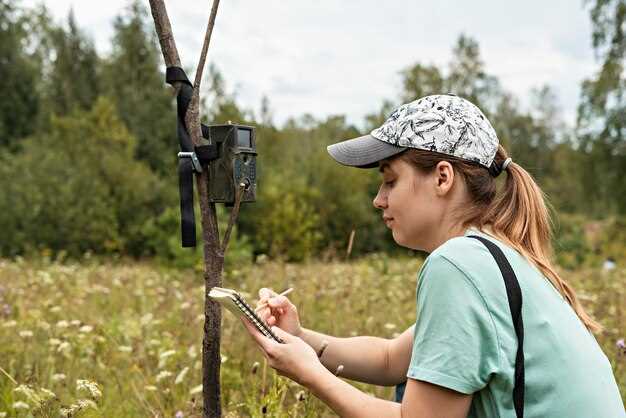
Moreover, in wildlife research and conservation efforts, rangefinders play a critical role in tracking animal movements and measuring habitat sizes. They provide researchers with accurate data that can inform conservation strategies, ultimately contributing to the protection of endangered species and ecosystems.
Overall, integrating rangefinders into fieldwork practices across various sectors not only enhances accuracy but also leads to increased efficiency, better resource management, and more informed decision-making. The impact of this technology continues to shape the future of professional measurements in the field.


